Sales

Hello LandBank

How does access to utilities affect land value?

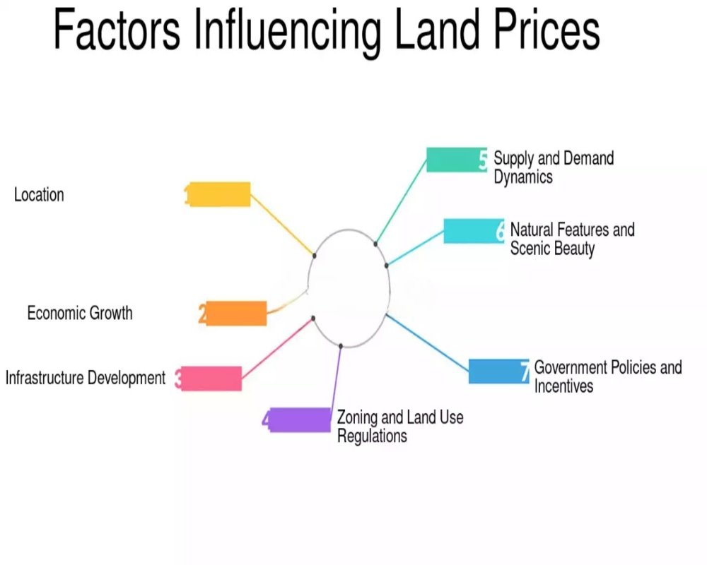
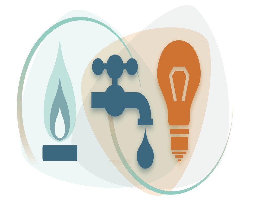
1. Reduction in Development Costs Access to essential utilities—such as electricity, water, sewage, and gas connections—significantly reduces the initial infrastructure investment required by the buyer. When these services are readily available: The buyer avoids the high cost of creating private utility lines. Development timelines are shortened. The land becomes immediately usable for...

Hello LandBank

What’s the impact of road frontage on price?

1. Enhanced Accessibility and Logistics Efficiency Industrial plots with significant road frontage offer easier access for transportation, particularly for large vehicles like trucks, trailers, and construction equipment. This is a key advantage for: Manufacturing units that require frequent inbound and outbound movement of goods. Warehousing and logistics hubs where turning radius and vehicle...

Hello LandBank

Who determines the circle rate for land?

1. State Government Revenue Departments The primary authority responsible for determining the circle rate (also known as guideline value, ready reckoner rate, or collector rate) is the Revenue Department of the respective state government. These departments operate under the framework of state-specific laws governing: Land registration Stamp duty collection Property taxation Each state in...

Hello LandBank

How do plot dimensions affect pricing?

1. Plot Size (Area Coverage) The overall size of the industrial plot significantly influences the price per square foot or per acre: Smaller plots (e.g., <1 acre) often have higher per sq. ft. rates due to accessibility to a larger pool of small and medium-scale buyers. Larger plots (e.g., 5–20 acres or more) may have a lower rate per sq. ft., but higher total value, suitable for major...

Hello LandBank

What factors influence the price of industrial land?

1. Location and Connectivity The geographic location of the land plays a critical role in determining its price. Key locational factors include: Proximity to national highways, expressways, and arterial roads Accessibility to ports, airports, railheads, and logistics hubs Distance from urban centers or major consumption zones Integration with industrial corridors, SEZs, or growth...

Hello LandBank

Where can I find current land pricing trends?

1. State Government Land and Revenue Portals Most Indian states maintain official online portals that provide land pricing data through: Circle rates / Ready reckoner rates Zonal value notifications District-wise land valuation records Examples include: IGR Maharashtra – For property valuation and ready reckoner rates Dharani Portal (Telangana) – Displays market values based on...

Hello LandBank

Why do prices vary across industrial zones?

1. Location and Accessibility One of the most significant factors influencing industrial land prices is geographic location and connectivity. Zones with better access to: Highways, ports, airports, and rail networks Urban centers and consumption markets Export corridors and logistic hubs tend to command higher prices due to reduced transport costs and enhanced operational efficiency....

Hello LandBank

How is industrial land valuation determined?

1. Market Value Analysis (Comparative Method) One of the most widely used approaches is the market value method, where the value of industrial land is determined based on: Recent sale prices of similar industrial plots in the vicinity. Demand-supply dynamics within the same industrial corridor or zone. Size, shape, and frontage of the land parcel. Valuers analyze benchmark transactions in...

Hello LandBank

What is the average price per square foot of industrial land?

1. Price Range Based on Location The average price per square foot (sq. ft.) of industrial land varies significantly depending on the geographic location, proximity to infrastructure, and zoning status. Here are typical price brackets across key regions in India: Tier 1 Cities (e.g., Mumbai, Delhi NCR, Bengaluru, Chennai):₹2,500 – ₹10,000 per sq. ft.High due to land scarcity, advanced...

Hello LandBank

Where can I find zoning maps for industrial land?

1. Local Urban Development or Town Planning Authority The primary source for zoning maps is the urban development authority or town planning department of the city or region where the land is located. These bodies are responsible for: Creating and updating the Master Plan or Development Plan. Publishing zoning classifications, including industrial zones. Providing official maps with...

Compare listings

Compare